

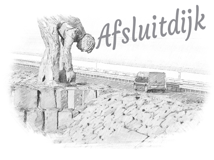
Afsluitdijk
The Dutch backbone
The Afsluitdijk, a remarkable engineering marvel in the Netherlands, has been a symbol of Dutch water management and connectivity for nearly a century. Stretching 32 kilometers across the IJsselmeer, this monumental dike was completed in 1932 to protect the low-lying Dutch landscape from the ravages of the North Sea and to tame the Zuiderzee’s once-unpredictable waters.
Designed by visionary engineer Cornelis Lely, the Afsluitdijk not only serves as a robust flood defense system but also connects the provinces of North Holland and Friesland, revolutionizing transportation and trade in the region. Its roadway facilitates both vehicular and pedestrian traffic, fostering vital links between communities and supporting economic growth.
Over the years, the Afsluitdijk has undergone essential upgrades to adapt to changing environmental conditions and ensure its continued effectiveness. Rising sea levels due to climate change led to heightening the dike’s elevation, reinforcing its storm barriers, and safeguarding the hinterland from potential threats.
Moreover, the Afsluitdijk showcases the Netherlands’ commitment to sustainable innovation. As a potential source of renewable energy, the dike is being explored for harnessing tidal and solar power to provide clean electricity to nearby communities.
Today, the Afsluitdijk remains a testament to the Dutch spirit of ingenuity and resilience, a true national treasure that protects, connects, and inspires both the Dutch people and the world at large.

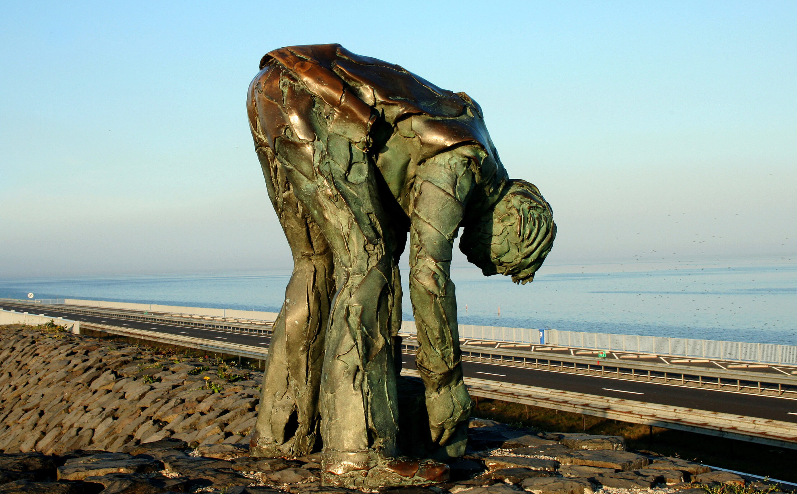
kazematten museum
During WWII, Dutch soldiers held off German forces at the Afsluitdijk causeway for three days, giving their compatriots more time to counterattack.
Despite eventually surrendering due to limited ammunition and overwhelming forces, the site is now seen as a symbol of Dutch resistance. The Afsluitdijk, originally built for storm surge protection, now serves as a crucial part of Dutch infrastructure as a major road link and renewable energy project.
afsluitdijk waddencentrum
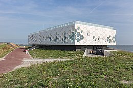
The Afsluitdijk Wadden Center is a modern visitor center on the famous dam separating the IJsselmeer and the Wadden Sea.
It offers an interactive experience showcasing the area’s history, architecture, and natural beauty. There are exhibits, a 4D tour, a rooftop terrace with panoramic views, and practical information about the area. It’s a great stop when traveling between North Holland and Friesland, easily accessible by car or bike, and offers a unique and educational experience for all ages.

stevinsluis
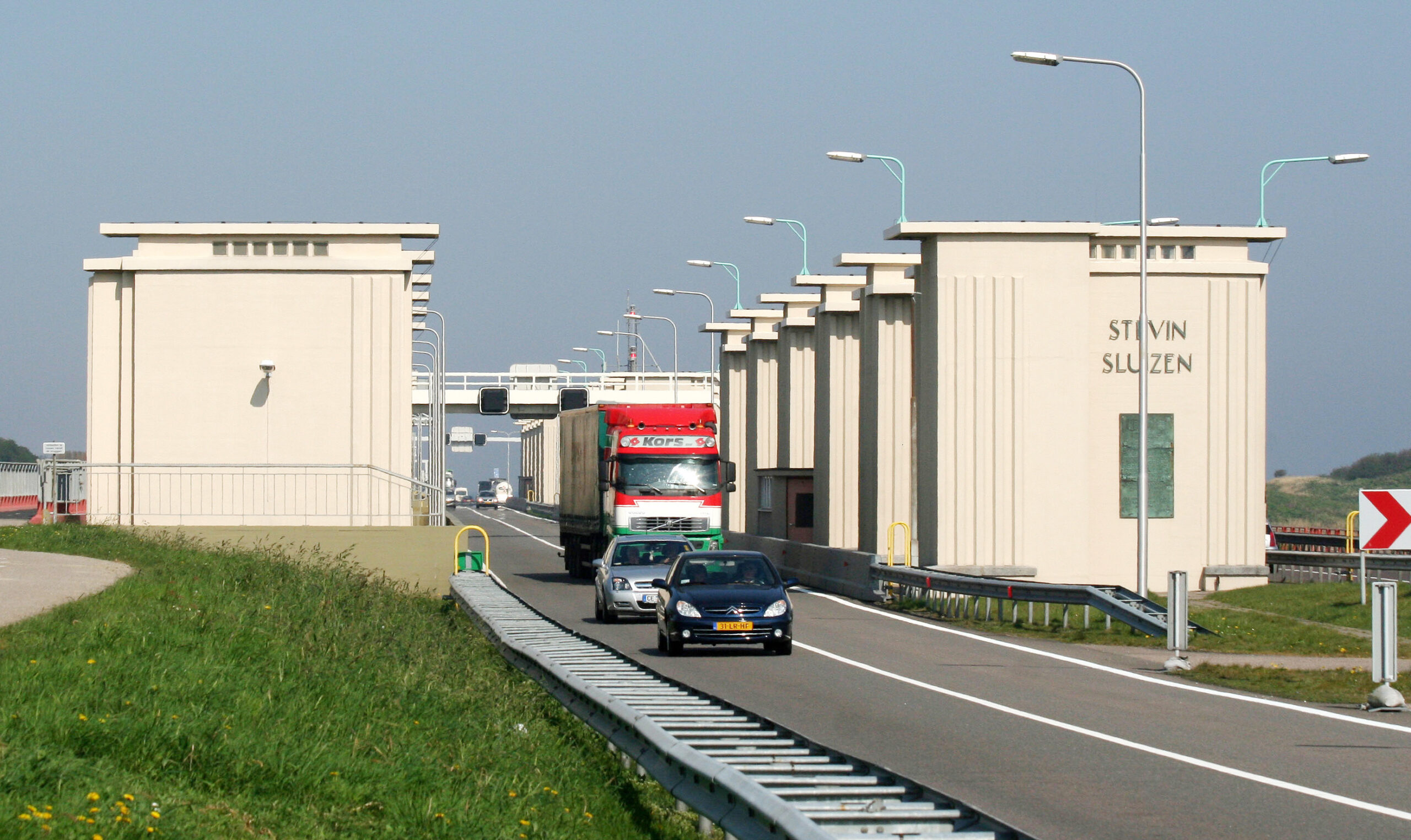
The Stevin sluice in Den Oever is a remarkable feat of Dutch engineering that regulates water levels for flood prevention. The massive concrete doors, weighing 3,500 tons, use hydraulic pumps and motors to raise or lower depending on the water level. The sluice, part of the Dutch water management system, protects the country from flooding and is also a reminder of the ongoing threat of climate change.
De Afsluitdijk: Een Meesterwerk van Nederlandse Waterbouwkund
De Afsluitdijk, een 32 kilometer lange dam die de voormalige Zuiderzee afscheidt van de Waddenzee, is een van de meest iconische waterbouwkundige werken van Nederland. Sinds de voltooiing in 1932 heeft deze imposante constructie een cruciale rol gespeeld in de bescherming van het land tegen overstromingen en bij het creëren van het IJsselmeer, een zoetwatermeer dat nu een belangrijke bron van drinkwater en recreatie is.
Geschiedenis en Constructie
Het idee voor de Afsluitdijk werd eind 19e eeuw geopperd door ingenieur Cornelis Lely, die zich zorgen maakte over de veiligheid van Nederland vanwege de frequente storingen. Na de verwoestende stormvloed van 1916 werd het plan voor de afsluiting van de Zuiderzee serieus opgepakt. In 1927 begon de bouw van de Afsluitdijk, een project dat vijf jaar later werd voltooid.
De constructie van de Afsluitdijk was een technisch hoogstandje. Miljoenen kubieke meters zand, klei en basaltblokken werden gebruikt om een solide en stabiele dam te bouwen die bestand was tegen de krachtige getijden en stromingen van de Waddenzee. Het midden van de dijk werd voorzien van sluizen en gemalen om het overtollige water uit het IJsselmeer te kunnen zuigen.
Waterbeheer en Veiligheid
De belangrijkste functie van de Afsluitdijk is het beschermen van Nederland tegen overstromingen. Door de Zuiderzee af te sluiten, werd de kans op verwoestende stormvloeden aanzienlijk verminderd. Het IJsselmeer zoveel nu als een buffer voor overtollig rivierwater, waardoor de waterstanden beter beheerd kunnen worden.
Zoetwatervoorziening
Met de afsluiting van de Zuiderzee ontstond het IJsselmeer, een groot zoetwatermeer. Dit meer is van vitaal belang voor de watervoorziening van Nederland. Het zoetwater wordt gebruikt voor drinkwater, landbouw en industrie, en helpt ook om de grondwaterstanden op peil te houden. Verkeer en Verbinding
De Afsluitdijk verbindt de provincies Noord-Holland en Fryslân en is een belangrijke verkeersader voor zowel wegen- als scheepvaartverkeer. De snelweg A7 loopt over de dijk en biedt een directe route tussen beide provincies. Daarnaast zijn er sluizen aangelegd om het scheepvaartverkeer tussen de Waddenzee en het IJsselmeer mogelijk te maken.
Vernieuwing en Toekomst
Na bijna een eeuw trouwe dienst is de Afsluitdijk toe aan een grondige renovatie. Sinds 2018 wordt er gewerkt aan een grootschalig versterkings- en vernieuwingstraject om de dijk toekomstbestendig te maken. De versterking is nodig vanwege de toenemende zeespiegel en toename van extreem weer als gevolg van klimaatverandering.
Een van de belangrijkste vernieuwingen is de aanleg van de vismigratierivier, die het voor vissen mogelijk maakt om tussen de Waddenzee en het IJsselmeer te migreren. Daarnaast worden nieuwe, krachtige gemalen om de waterafvoer te verbeteren en wordt de dijk zelf versterkt met nieuwe bekledingsmaterialen die beter zijn bestand tegen de krachten van de natuur.
Cultureel en Recreatief Belang
De Afsluitdijk heeft ook een belangrijke culturele en recreatieve waarde. Het is een geliefde bestemming voor toeristen, fietsers en wandelaars die genieten van het unieke landschap en de indrukwekkende landschappen. Daarnaast zijn er verschillende kunstinstallaties en monumenten langs de dijk te vinden, die de rijke geschiedenis en het ingenieursvernuft van Nederland vieren.
De Afsluitdijk is meer dan slechts een dam; het is een symbool van Nederlandse inventiviteit en vasthoudendheid in de strijd tegen het water. Met de huidige renovaties zal de dijk ook in de toekomst een essentiële rol blijven spelen in het beschermen en verbinden van Nederland. De combinatie van waterbeheer, infrastructuur en cultuur maakt de Afsluitdijk tot een uniek en essentieel onderdeel van het Nederlandse landschap.
The Afsluitdijk Tower is a visitors’ center located on a 32-kilometer-long Dutch dam built to prevent flooding in the country.
It was designed by Wouter Valkenier and completed in 2019. The tower offers an observation deck with a panoramic view, as well as exhibition space, a café, and a souvenir shop. It is also an example of sustainable architecture, using renewable energy sources and environmentally-friendly materials.
THE AFSLUITDIJK
The Afsluitdijk is important to protect all of the Netherlands against flooding.
The Afsluitdijk is part of the Delta Works. Construction started in 1927. In 1932 the last closing hole, the Vlieter, was closed.
There are locks for shipping and sluices on both sides of the Afsluitdijk. Against North Holland it is the Stevin locks. The Lorentz locks are located on Kornwerderzand, more than 4 km from Friesland. The entire dike is 32.5 km long, the water retaining part of it is 30 km. is the flood defense between North Holland and Friesland, which closes off the IJsselmeer from the Wadden Sea. This is where the dam gets its name.
FLOOD OF 1953
Spring tide and a northwesterly storm caused major flooding in the southwest of the Netherlands, Belgium and England in 1953.
The Afsluitdijk had a hard time, but held its own. As a result, floods around the IJsselmeer did not occur. Afterwards it was said that the Afsluitdijk had paid for itself in one night.
European walking route E9
The European walking route E9 runs across the dike, which is the North Sea Path or North Sea Trail. The E9 runs along the coast from Portugal to the Baltic Statesperformance lab