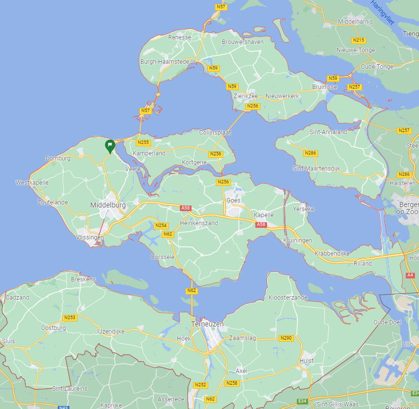
During the 16th and 17th centuries, Zeeland, like Holland, experienced a great heyday. A number of Zeeland towns, such as Middelburg, Vlissingen, Zierikzee and Veere, played a significant role in the Low Countries as an international port. Until the end of the 16th century, Middelburg was the largest trading city in the Northern Netherlands (Republic of the Seven United Netherlands) and until the third quarter of the 17th century, with 27,000 to 30,000 inhabitants, the fifth largest city (more inhabitants then The Hague and Utrecht) of the country. Until the last quarter of the 17th century, Middelburg was the largest port of the Republic after Amsterdam.
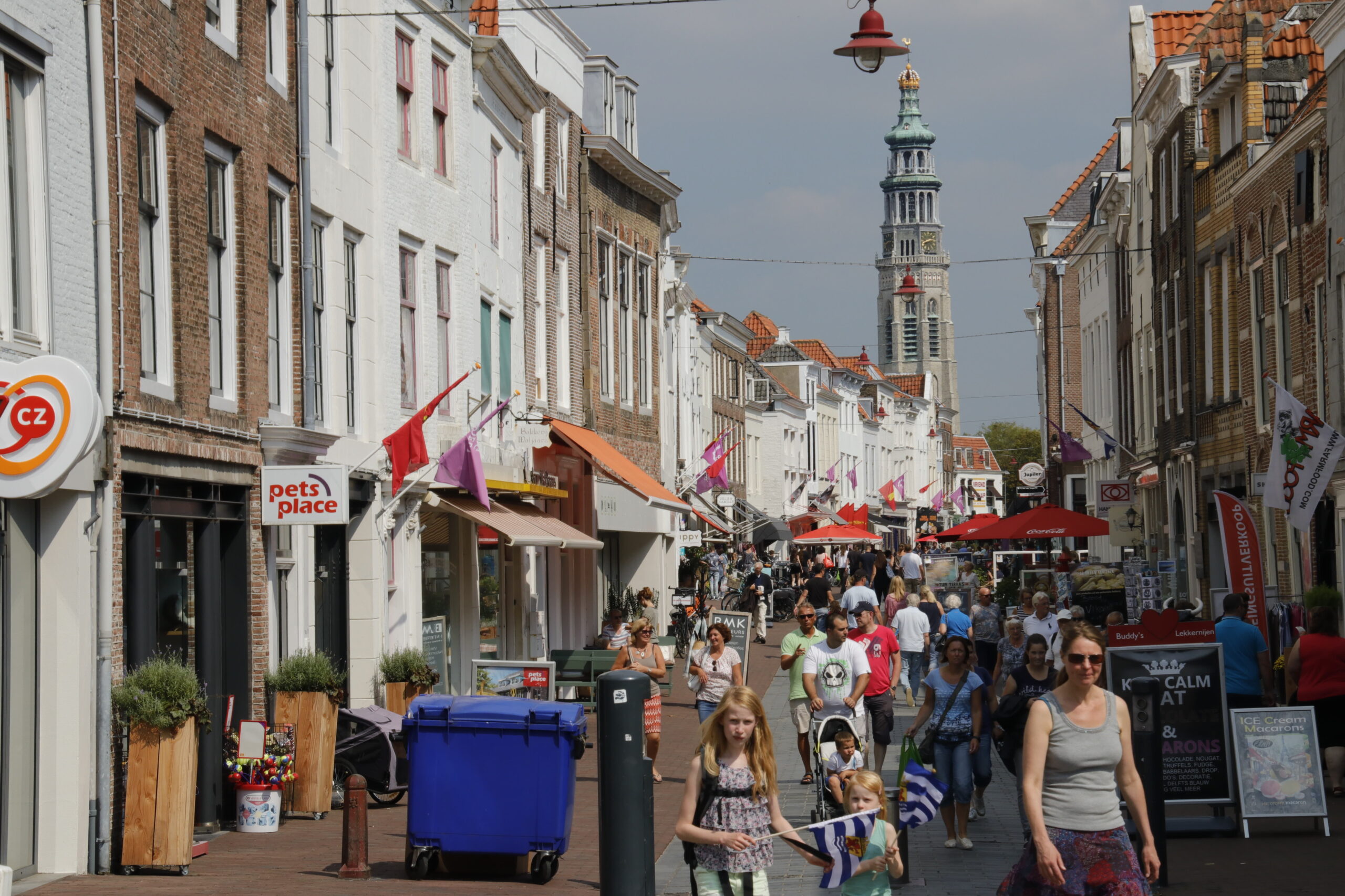
Middelburg shopping.
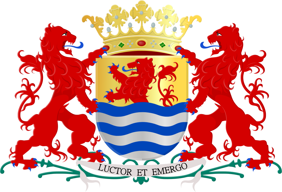
The Coat of Arms of Zeeland was officially established (in traditional form) on December 4, 1948 by Royal Decree. The spell under the coat of arms is ‘Luctor et Emergo’: I struggle and come up. The weapon gives the impression that the spell relates to the struggle against the water (after all, the depicted lion seems to rise from the water). However, that assumption is based on a misunderstanding. The fight that is meant is that against the Spaniards.
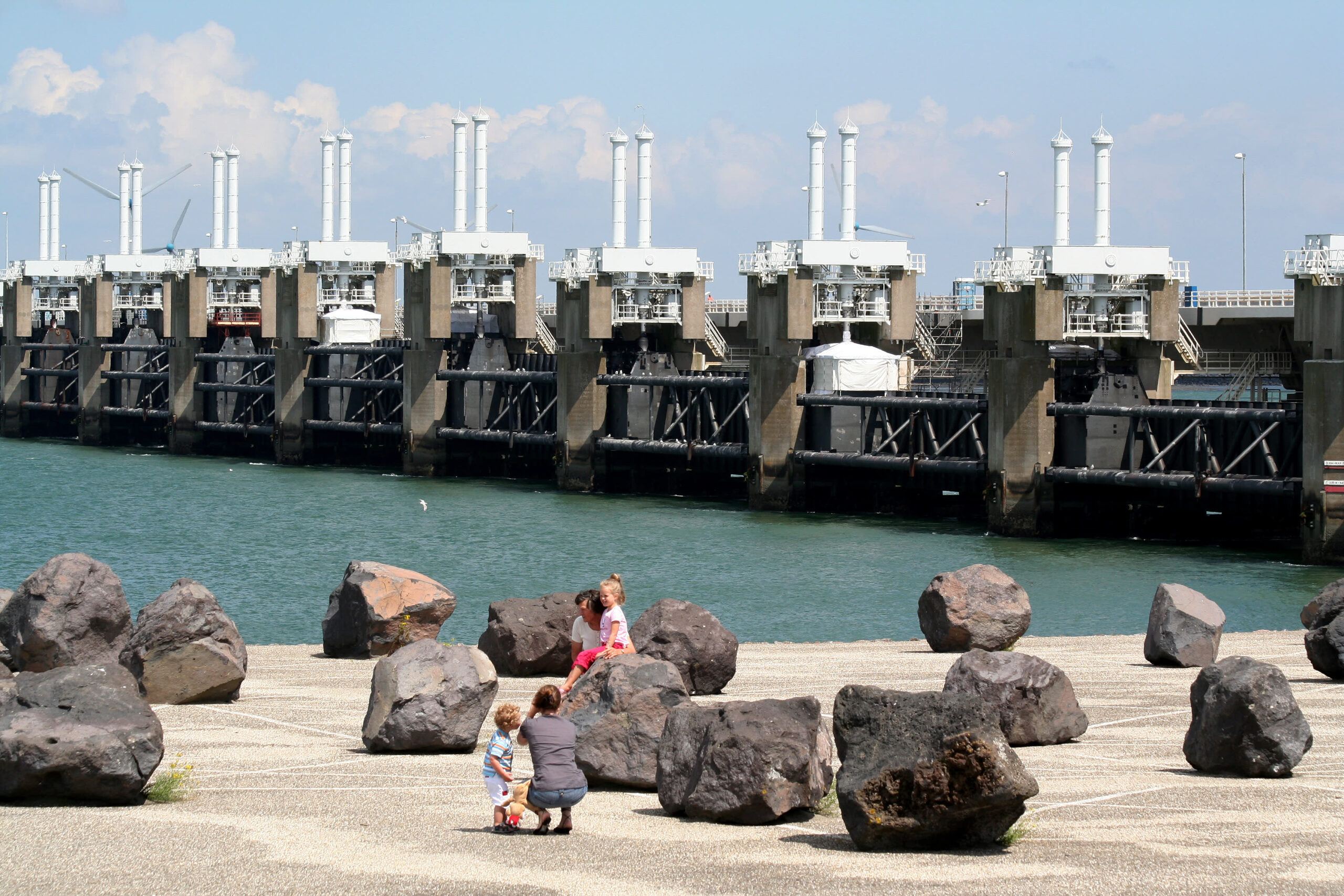
Eastern Scheldt Storm Surge Barrier,
Eastern Scheldt storm surge barrier
The Eastern Scheldt Storm Surge Barrier, also known as the Oosterscheldekering, is a large storm surge barrier located in the Netherlands. It is part of the larger Delta Works project, a series of water management infrastructure projects designed to protect the low-lying areas of the country from the threat of flooding.
The Eastern Scheldt Barrier was constructed in response to the devastating North Sea flood of 1953, which caused widespread destruction and loss of life in the Netherlands. The barrier’s primary purpose is to protect the southwestern part of the country, particularly the province of Zeeland, from storm surges and high tides.
The barrier consists of a series of movable barriers that span the Eastern Scheldt estuary, which connects the North Sea to the Scheldt River. The barriers can be closed during periods of high water to block the incoming tides and prevent flooding. When the barriers are open, the estuary functions as a tidal saltwater habitat, allowing for the preservation of the unique ecosystem and maintaining the natural tidal flow.
The construction of the Eastern Scheldt Storm Surge Barrier was a significant engineering feat. It involved the creation of several artificial islands and the installation of 65 concrete pillars, each weighing around 18,000 tons. These pillars support the movable barriers, which are comprised of large steel gates. The barrier system is controlled by a computerized monitoring and control system that automatically closes the barriers when water levels rise above a certain threshold.
The Eastern Scheldt Barrier was completed in 1986 and has since played a crucial role in protecting the region from storm surges. It stands as a testament to the Netherlands’ expertise in water management and engineering and is recognized as one of the Seven Wonders of the Modern World by the American Society of Civil Engineers.
flood Disaster
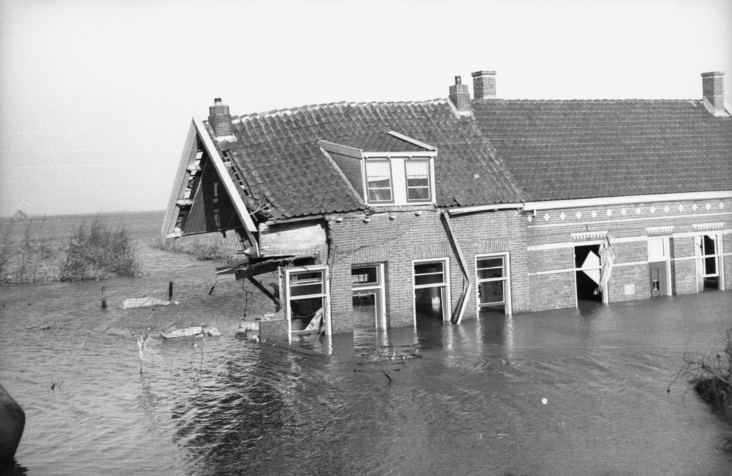
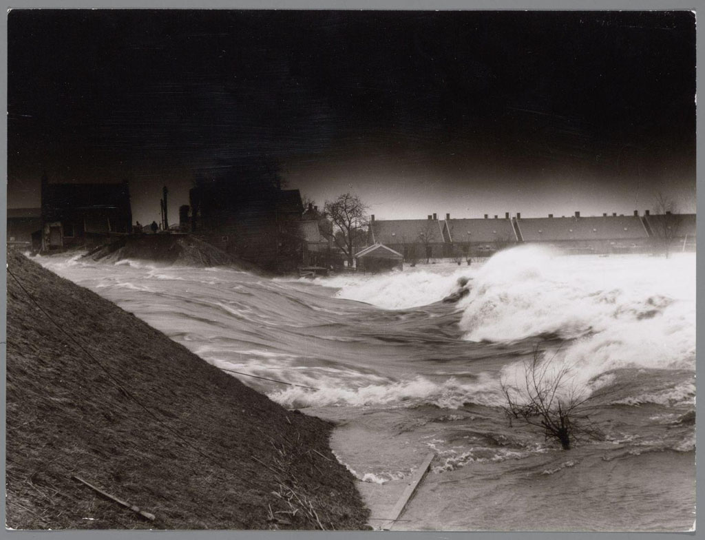
The flood of 1953, usually referred to as the Flood Disaster or February Disaster and initially also as the St. Ignatius Flood or Beatrix Flood, took place in the night of Saturday 31 January to Sunday 1 February 1953. The disaster was the result of a combination of a severe storm from the northwest, with an unfavorably coinciding time of high tide and spring tide. As a result, the water in the funnel-shaped southern North Sea rose to extreme heights. The highest water level in 100 years was measured at Hoek van Holland, IJmuiden and Harlingen, respectively 3m40, 3m85 and 3m85 higher than normal.
The result was that many dikes were flooded and breached. Entire islands and regions including towns and villages were flooded; this led to many casualties and extensive damage. The number of deaths was 1,836 in the Netherlands, 307 in the United Kingdom, 224 at sea, including 133 in the wreck of an English ferry and 28 in Belgium. The disaster prompted the development of a much improved coastal defense system with heavy storm surge barriers. The Delta Works in the Netherlands are the most drastic, while the Thames Barrier and a storm surge barrier in the River Hull have been built in England
Watersnoodmuseum
The Watersnoodmuseum is a museum in the Netherlands dedicated to the flood disaster of 1953. The Watersnooddisaster was a major flood disaster that occurred on February 1, 1953, in which large parts of the Southwestern delta of the Netherlands were inundated by seawater, resulting in more than 1800 deaths and thousands of homeless people.
The museum is housed in the four caissons that were used to close the last hole in the dikes after the flood disaster. Caissons are large concrete structures that were used to repair the dikes and close the gap in the dike. After the dikes were repaired, the caissons remained and were later transformed into the Flood Museum.
The Watersnoodmuseum tells the story of the flood disaster, its impact on the people and the measures taken to prevent a recurrence. The museum also shows the history of the delta region of the Netherlands and the importance of water management in a low-lying country like the Netherlands.
The Watersnoodmuseum is an important memorial and educational site where visitors can learn more about this dramatic event in Dutch history and the efforts to protect the country from future flooding.