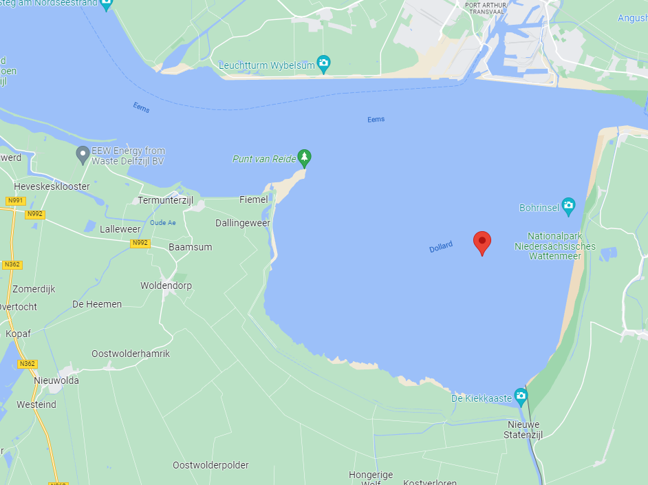
The Dollard is an approximately 100 km² estuary that was created by a storm surge in the late Middle Ages.
The water in the Dollard is a mix of fresh and salt water, which means that many brackish water birds and plants can be found here. Due to the direct connection to the sea, the tides are clearly visible. The difference between high and low water can be up to three meters. Sediments are transported from the adjacent Wadden Sea to the Dollard through natural flow processes. This natural supply is nowadays enhanced by anthropogenic influences.
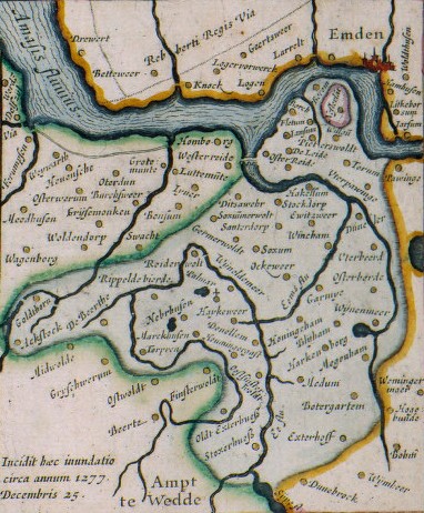
The name Dollard appears for the first time around 1485 in the monastery chronicle of Aduard. This name is probably derived from ‘large hole in the ground, pool’, ‘pit’ or perhaps ‘dead pit’ (dole). But this name was soon explained from the “mad nature” of the sea-bosom, because of “the tumult and violence of the waves and the raging storms in that place”—as Ubbo Emmius summed it up about 1600—”because of the frenzy of his waves”. Due to the origin of the Dollard and the breakthroughs along the Ems, at least twenty church villages, ten to fifteen smaller hamlets and three monasteries have been lost. About a dozen village churches were moved one or more times
Map of the drowned Dollarddorpen by Ubbo Emmius (1630) based on the work of Jacob van der Meersch from 1574